I survived another trek to Supai! I'm not a serious backpacker. I am more of a faire-weather backpacker. Strictly a light-weight. I take it easy and luxurious wherever I can. As you will see if you read on.
So, as a "shake-down" hike for a future Grand Canyon rim-t0-rim, I thought I would be far enough along (by now) with my conditioning routine that I could once again successfully manage a jaunt to Supai, and the blue green waterfalls of the Havasupai Reservation. I was wrong about that.
I did make it, but I have a dreadful case of the Supai-shuffle and my knees may never be the same. I say the same thing of course, after every visit there and this was my seventh.
The conditions were actually pretty ideal; they had had rain and cloudy weather the past few days, with intermittent sunshine and heat. It was our good luck that those conditions continued throughout our visit (friend Linda went along for her second trip to the village and the waterfalls).
We left Phoenix on Thursday afternoon and stayed overnight in Seligman, AZ. We stayed at the Supai Motel in Seligman, which was plain but clean. Check-in was friendly, the price was a bit high, but not terribly so; $75 inclusive for all.
To hike the trail from Hualapai Hilltop (the trailhead 60 miles north of old Route 66 on Route 18) in summer, you are smart to hike very early. You want to be in the village and out of the sun on a summer day by 9:00 am if you can. This means arriving the night before and sleeping in the parking lot in your car (I've done that, no thanks), or getting a room as close as you can and finishing the drive before your hike. That's what I like to do.
There is lodging available in Peach Springs, which is the closest to Hualapai Hilltop (except for the motel at Grand Canyon Caverns), but my custom has been to stay in Seligman and that works OK as well and there are more choices there. From Seligman it is about 90 miles to Hilltop. Route 18 is not a terribly quick road and there are almost always cattle on the road at some point, so you have to allow yourself plenty of time. I always plan to be on the trail at first light in the summertime around here -- and that's 5:15 am or so. By the way, Hualapai is pronounced WAL-a-pie.
This time though, we didn't get there that early. We arrived at more like 6:30 or 6:45 or so. We got ourselves packed-up, trail-ready and hiking by 7:00 am. It was a cool morning so we didn't suffer for the late start.
The first part of the Havasupai Trail is down some fairly respectable switchbacks -- about a mile and a half of them. Along these upper reaches of the trail, we got overtaken by a small herd of cattle being driven down to the village by some "outside" wranglers and some tribal members. We stood aside behind a short retaining wall and we still weren't out of the way. One errant steer came trotting down the narrow culvert behind the wall where we were cowering. When he saw us, he ambled back over the wall at a low spot and went on by. I knew he would do that. 'Cause I knows cows. Ain't skeered o' no dogie.
We hiked along at an easy pace and stopped about every 45 or 50 minutes for a short break, rest the shoulders and have a snack. My day pack was cutting into my left shoulder a little and stressing my neck. I regularly dosed the afflicted area with some pain-relief rub (good old Flexall 454) and kept plugging along, only complaining when someone was within ear-shot.
My legs were kind of numb after the switchbacks. They weren't aching or hurting, but I stumbled quite a bit. I felt like they were flailing along like a windmill without much control. I must've been OK though, because I didn't fall down more than a dozen times or so. Truth be told, I didn't hike as quickly as I usually do on this trail, reflecting my low-level of conditioning at present. The hike to the village took quite a bit longer than what I could do if I were in better shape. I drank three 23 oz bottles of water and had a 4th along for a spare.
One mistake people often make when hot weather hiking -- they don't drink their water. If you are moving downhill in shade, it is easy to forget to drink because you don't always "feel" thirsty; but be assured, your body needs that water. Drink it regularly while you hike. On my first hike to Supai in the mid-eighties I made that mistake and was heat-sick by the time I got to town. People who over-exert themselves on Grand Canyon trails or don't drink enough water die occasionally.
It started to get more difficult toward the end; we hit the sun and by the time we reached the outskirts of Supai I was ready to be finished, no question. We arrived at the lodge during their lunch hour, so we went back to the cafe for a rest and I had lunch. That was the only meal I ate in the cafe during this trip.
The menu is strictly "fast food" these days. There used to be chili and beef stew if I remember correctly, but not anymore. The service was friendly but extremely s-l-o-w. I ordered a burger and tater tots; there were a total of about ten tickets on the order board when I ordered and I was still waiting for my food about 90 minutes later. That's just the way it is in Supai. They only have two speeds -- if you don't like the one you've got, you sure as hell won't like the other one, so don't complain. Linda and I just sat there and chatted until the ordeal was over. With good company, the time goes quickly anyway.
For all my other meals, I ate a combination of my own snacks plus some items to supplement them from the Supai store - a loaf of bread, lunch-meat, fruit, DIET COKES (which were icy cold, by the way). Prices are exorbitant in Supai, but remember that everything is either packed from Hilltop via mule or horse, or brought in by air. So my "chopped ham" and bread were subject to the $600 per hour tariff of a helicopter ride. In addition, all the trash is ultimately packed out so that's an added expense as well. If you don't want to pay a share of the costs of your visit, DON'T GO. Avoid disappointment, I always say.
After lunch and shopping at the store, we walked back to the hotel and got our room and I took a nice refreshing cold shower. (Yes, there was hot water, but I wanted cold). Then like a true vacationer, I had a nice nap. Linda read her book, and she napped too. We weren't planning on doing any further hiking that day; we just relaxed and kept an eye on "things" in town.
The room was clean and comfortable. It occurs to me that the nicest person I encountered on this trip to Supai was the hotel maid. She had a smile and a friendly hello every time I ran into her. And I forgot to leave her a tip. What a bum I turned out to be. The Lodge manager was also fairly friendly and helpful.
People who visit Supai often complain about how unfriendly the locals are. The only surliness I encountered on this visit was from a couple of young men (which has been the case in the past, too). Injustice rests most heavily on the young, no matter where you are. Most of the time though, the Havasupai people you meet will return a hello, or give you a nod as they ride past on their horses. People mistake a taciturn nature for hostility. They are usually wrong.
If you are not familiar, the main attraction of a visit to Supai and the Havasupai Reservation is a series of several gorgeous turquoise-blue waterfalls. The hike to Supai is about eight or nine miles from Hilltop depending on which sign you believe, but the waterfalls are another two miles or so farther downstream. So if you are using the village lodge as a base (instead of camping), you have a roughly 2-mile walk each-way every time you want to go. Campers, on the other hand, are located in the shaded land between Havasu and Mooney Falls.
I figured we'd probably hike to the falls twice -- once for swimming, once for photos. In the end we did everything in one trip and didn't go back the second time. The hike back to the village in the afternoon sun was uphill and blisteringly hot, so we only did it once. That was the only uncomfortable hike we had. The others were all in much cooler conditions, which is really unusual in the summer and we were fortunate in that regard.
We could've gone back to the falls in late afternoon and walked back in the last light of the evening and it would have been much more comfortable. But I was busy napping by then. Anyway, I took two bottles of water on the hike from the village to the falls and that turned out to be just about right. We spent a couple of hours at the falls, swimming and people-watching.
For this trip, we were more limited than usual because a flood had damaged things on Wednesday (the area is subject to frequent flash floods during the summer rainy season). So the trail below Havasu Falls was closed. If you hike about 1.25 miles farther down the trail from Havasu Falls, through the campground, you come to Mooney Falls, the tallest of all the falls in Cataract Canyon and named for an early "explorer" who fell to his death there. We missed Mooney this time because of the storm damage and resulting closure.
But we hiked as far as Havasu Falls and spent about 3 hours there soaking in the fast-moving cool waters and watching all the other people who were doing the same thing. Then I put my hiking shoes back on and bitched and moaned my way back to the village in the hot summer sun.
I planned on a cold shower upon arrival. I lusted for it, I dreamed about it. I stumbled along in the 100 degree sunshine positively feeling that cold water, refreshing me, soothing me, cooling me down after my hike, getting the dust off. Alas. Upon arrival at the Supai Lodge, the water lines were empty. They remained so for the next several hours. The next time any water flowed through the Supai Lodge pipes it was late in the evening. I had long since given up the idea and gone to bed.
At one point, I asked the hotel manager about the lack of water. She gave me a blank stare and stated that she "didn't know anything about that." I have learned during my many visits with the Havasupai that the proper response at such times is silence and patience. After a few moments, she said "maybe the power outages had affected the pumps -- or something -- and eventually it would get fixed." You just have to remain patient. This ain't the Waldorf Astoria.
Eventually, we had water again, but it arrived on Indian time (that's not criticism). "Type A" people may not be able to enjoy the relaxed pace of a place like this, but I sure can.
We spent some time watching the village's stray dogs, reading books we found in the lodge "lobby" and playing cards. I won the last round in sudden death so I am champion of the world in Crazy Eights. We both laughed at my pathetic attempts to shuffle a deck of cards, an art I have never mastered. There are no public telephones, no television, and no cell phone service in Supai. In Supai, you'd better know how to entertain yourself the old-fashioned way.
The last (third) morning, I woke up about 6:30 am and got up and moving -- finally had that shower, walked downtown to see what was "up," and waited around.
We had decided to seize the opportunity of a helicopter ride out of the canyon. The hike out wouldn't have been difficult except for the last 1.5 miles of switchbacks, which are always tough. I have hiked them with pack and without, six prior times. But...
When I discovered (on arrival at the cafe on Friday) that a first-come first-served helicopter flight was only $85, there was no question in my mind what I wanted to do. I considered that price so reasonable that I offered to pay Linda's fare too if she was in some way reluctant or unable. I was sold. I begged, I whined, I pleaded and Linda finally saw the wisdom of my plan. How can you possibly spend four tortuous hours on a hot, dry trail when a four-minute helicopter ride covers the same distance for only $85. Eighty-five dollars! Woo HOO! Especially when your knees are still suffering from the downhill hike.
The way it works is you show up at the designated time and you put your names on the list. I hoped the guy-in-charge would show up early, but he did not. I kept checking though. The appointed time was 10:00 am. The chopper would fly from 10:00 - 1:00 pm.
At about 9:30 am, Linda and I walked down to the plaza where the heli-pad is. This is the hub of activity in Supai. The cafe is there, the store is there, the meeting hall is there. The school is there, the clinic, everything almost -- including the helicopter. Only the lodge is a little ways away, around the corner and behind the Christian church (a surplus Quonset Hut). Those wanting to fly were mostly already waiting. Those who were hiking were on the trail already, trudging up the dry, hot canyon toward the switchbacks.
We went back and got our stuff together, turned in our room key, then returned to the "plaza"and waited by the "terminal" gate. There actually is no terminal but there is a gate in the chain link fence surrounding the grass patch that calls itself an "airport."
We put our names on the roster, paid our $85, and waited for the man to call us for our flight. The helicopter was a bit late, but no one seemed to notice.
Each round trip to Hilltop takes 15 minutes. About 7.5 min up, and 7.5 min back, including loading and unloading time. I think we got on the second "revenue" flight; the first flight was to drop the up-top staff at Hilltop, the second trip was the first revenue flight, and we got on the third one -- to the great consternation of some fairly pushy Germans who thought they should be first and shoved their way to the front of the line at every opportunity. I grinned about that, but it wasn't personal, it was strictly a matter of weight and balance. Linda and I simply fit the load requirements on that particular flight better. The German tourists got on the next flight, I think.
The ride out of the canyon was quick and spectacular. It follows the general path of the trail below, so at certain points you can look down and see those poor souls trudging along in the sand and rocks. Poor bastards.
Once alight at Hilltop, we got into the cold drinks I always leave in the car, in an ice chest crammed with ice to the top (yes, it stays very cold for the three days of a Supai trip). We took a couple more photos and then hit the road for home. It's about 250 miles, so while not a short drive it isn't a particularly long one either. We had lunch along the way and we were home by about 4:30 pm or so.
I am now a veteran of 6.5 hikes (and one helicopter ride) to and from the Havasupai reserve, dating from about 1985 or so. I'm more than willing to answer questions about things I have learned from that experience. If you have stumbled across this essay and have questions about visiting the Havasupai people and their home in the Grand Canyon, you may send me a note at trafficschoolbob43(at)yahoo(dot)com.
There is no other place quite like it in the United States, perhaps not even in the world.
So, as a "shake-down" hike for a future Grand Canyon rim-t0-rim, I thought I would be far enough along (by now) with my conditioning routine that I could once again successfully manage a jaunt to Supai, and the blue green waterfalls of the Havasupai Reservation. I was wrong about that.
I did make it, but I have a dreadful case of the Supai-shuffle and my knees may never be the same. I say the same thing of course, after every visit there and this was my seventh.
The conditions were actually pretty ideal; they had had rain and cloudy weather the past few days, with intermittent sunshine and heat. It was our good luck that those conditions continued throughout our visit (friend Linda went along for her second trip to the village and the waterfalls).
We left Phoenix on Thursday afternoon and stayed overnight in Seligman, AZ. We stayed at the Supai Motel in Seligman, which was plain but clean. Check-in was friendly, the price was a bit high, but not terribly so; $75 inclusive for all.
 |
| The View from Hualapai Hilltop |
There is lodging available in Peach Springs, which is the closest to Hualapai Hilltop (except for the motel at Grand Canyon Caverns), but my custom has been to stay in Seligman and that works OK as well and there are more choices there. From Seligman it is about 90 miles to Hilltop. Route 18 is not a terribly quick road and there are almost always cattle on the road at some point, so you have to allow yourself plenty of time. I always plan to be on the trail at first light in the summertime around here -- and that's 5:15 am or so. By the way, Hualapai is pronounced WAL-a-pie.
 |
| Headed down the Switchbacks on the Havasupai Trail |
This time though, we didn't get there that early. We arrived at more like 6:30 or 6:45 or so. We got ourselves packed-up, trail-ready and hiking by 7:00 am. It was a cool morning so we didn't suffer for the late start.
The first part of the Havasupai Trail is down some fairly respectable switchbacks -- about a mile and a half of them. Along these upper reaches of the trail, we got overtaken by a small herd of cattle being driven down to the village by some "outside" wranglers and some tribal members. We stood aside behind a short retaining wall and we still weren't out of the way. One errant steer came trotting down the narrow culvert behind the wall where we were cowering. When he saw us, he ambled back over the wall at a low spot and went on by. I knew he would do that. 'Cause I knows cows. Ain't skeered o' no dogie.
 |
| Along the Havasupai Trail |
We hiked along at an easy pace and stopped about every 45 or 50 minutes for a short break, rest the shoulders and have a snack. My day pack was cutting into my left shoulder a little and stressing my neck. I regularly dosed the afflicted area with some pain-relief rub (good old Flexall 454) and kept plugging along, only complaining when someone was within ear-shot.
My legs were kind of numb after the switchbacks. They weren't aching or hurting, but I stumbled quite a bit. I felt like they were flailing along like a windmill without much control. I must've been OK though, because I didn't fall down more than a dozen times or so. Truth be told, I didn't hike as quickly as I usually do on this trail, reflecting my low-level of conditioning at present. The hike to the village took quite a bit longer than what I could do if I were in better shape. I drank three 23 oz bottles of water and had a 4th along for a spare.
One mistake people often make when hot weather hiking -- they don't drink their water. If you are moving downhill in shade, it is easy to forget to drink because you don't always "feel" thirsty; but be assured, your body needs that water. Drink it regularly while you hike. On my first hike to Supai in the mid-eighties I made that mistake and was heat-sick by the time I got to town. People who over-exert themselves on Grand Canyon trails or don't drink enough water die occasionally.
It started to get more difficult toward the end; we hit the sun and by the time we reached the outskirts of Supai I was ready to be finished, no question. We arrived at the lodge during their lunch hour, so we went back to the cafe for a rest and I had lunch. That was the only meal I ate in the cafe during this trip.
 |
| Supai Cafe and Village Square |
The menu is strictly "fast food" these days. There used to be chili and beef stew if I remember correctly, but not anymore. The service was friendly but extremely s-l-o-w. I ordered a burger and tater tots; there were a total of about ten tickets on the order board when I ordered and I was still waiting for my food about 90 minutes later. That's just the way it is in Supai. They only have two speeds -- if you don't like the one you've got, you sure as hell won't like the other one, so don't complain. Linda and I just sat there and chatted until the ordeal was over. With good company, the time goes quickly anyway.
For all my other meals, I ate a combination of my own snacks plus some items to supplement them from the Supai store - a loaf of bread, lunch-meat, fruit, DIET COKES (which were icy cold, by the way). Prices are exorbitant in Supai, but remember that everything is either packed from Hilltop via mule or horse, or brought in by air. So my "chopped ham" and bread were subject to the $600 per hour tariff of a helicopter ride. In addition, all the trash is ultimately packed out so that's an added expense as well. If you don't want to pay a share of the costs of your visit, DON'T GO. Avoid disappointment, I always say.
After lunch and shopping at the store, we walked back to the hotel and got our room and I took a nice refreshing cold shower. (Yes, there was hot water, but I wanted cold). Then like a true vacationer, I had a nice nap. Linda read her book, and she napped too. We weren't planning on doing any further hiking that day; we just relaxed and kept an eye on "things" in town.
 |
| Supai Lodge |
The room was clean and comfortable. It occurs to me that the nicest person I encountered on this trip to Supai was the hotel maid. She had a smile and a friendly hello every time I ran into her. And I forgot to leave her a tip. What a bum I turned out to be. The Lodge manager was also fairly friendly and helpful.
People who visit Supai often complain about how unfriendly the locals are. The only surliness I encountered on this visit was from a couple of young men (which has been the case in the past, too). Injustice rests most heavily on the young, no matter where you are. Most of the time though, the Havasupai people you meet will return a hello, or give you a nod as they ride past on their horses. People mistake a taciturn nature for hostility. They are usually wrong.
If you are not familiar, the main attraction of a visit to Supai and the Havasupai Reservation is a series of several gorgeous turquoise-blue waterfalls. The hike to Supai is about eight or nine miles from Hilltop depending on which sign you believe, but the waterfalls are another two miles or so farther downstream. So if you are using the village lodge as a base (instead of camping), you have a roughly 2-mile walk each-way every time you want to go. Campers, on the other hand, are located in the shaded land between Havasu and Mooney Falls.
 |
| Navajo Falls -- the trail below the village. |
We could've gone back to the falls in late afternoon and walked back in the last light of the evening and it would have been much more comfortable. But I was busy napping by then. Anyway, I took two bottles of water on the hike from the village to the falls and that turned out to be just about right. We spent a couple of hours at the falls, swimming and people-watching.
For this trip, we were more limited than usual because a flood had damaged things on Wednesday (the area is subject to frequent flash floods during the summer rainy season). So the trail below Havasu Falls was closed. If you hike about 1.25 miles farther down the trail from Havasu Falls, through the campground, you come to Mooney Falls, the tallest of all the falls in Cataract Canyon and named for an early "explorer" who fell to his death there. We missed Mooney this time because of the storm damage and resulting closure.
 |
| Havasu Falls |
But we hiked as far as Havasu Falls and spent about 3 hours there soaking in the fast-moving cool waters and watching all the other people who were doing the same thing. Then I put my hiking shoes back on and bitched and moaned my way back to the village in the hot summer sun.
 |
| Doing what people do at Havasu Falls |
At one point, I asked the hotel manager about the lack of water. She gave me a blank stare and stated that she "didn't know anything about that." I have learned during my many visits with the Havasupai that the proper response at such times is silence and patience. After a few moments, she said "maybe the power outages had affected the pumps -- or something -- and eventually it would get fixed." You just have to remain patient. This ain't the Waldorf Astoria.
Eventually, we had water again, but it arrived on Indian time (that's not criticism). "Type A" people may not be able to enjoy the relaxed pace of a place like this, but I sure can.
 |
| Walking around Supai |
The last (third) morning, I woke up about 6:30 am and got up and moving -- finally had that shower, walked downtown to see what was "up," and waited around.
 |
| Waitin' around in Supai |
We had decided to seize the opportunity of a helicopter ride out of the canyon. The hike out wouldn't have been difficult except for the last 1.5 miles of switchbacks, which are always tough. I have hiked them with pack and without, six prior times. But...
When I discovered (on arrival at the cafe on Friday) that a first-come first-served helicopter flight was only $85, there was no question in my mind what I wanted to do. I considered that price so reasonable that I offered to pay Linda's fare too if she was in some way reluctant or unable. I was sold. I begged, I whined, I pleaded and Linda finally saw the wisdom of my plan. How can you possibly spend four tortuous hours on a hot, dry trail when a four-minute helicopter ride covers the same distance for only $85. Eighty-five dollars! Woo HOO! Especially when your knees are still suffering from the downhill hike.
The way it works is you show up at the designated time and you put your names on the list. I hoped the guy-in-charge would show up early, but he did not. I kept checking though. The appointed time was 10:00 am. The chopper would fly from 10:00 - 1:00 pm.
At about 9:30 am, Linda and I walked down to the plaza where the heli-pad is. This is the hub of activity in Supai. The cafe is there, the store is there, the meeting hall is there. The school is there, the clinic, everything almost -- including the helicopter. Only the lodge is a little ways away, around the corner and behind the Christian church (a surplus Quonset Hut). Those wanting to fly were mostly already waiting. Those who were hiking were on the trail already, trudging up the dry, hot canyon toward the switchbacks.
We went back and got our stuff together, turned in our room key, then returned to the "plaza"and waited by the "terminal" gate. There actually is no terminal but there is a gate in the chain link fence surrounding the grass patch that calls itself an "airport."
 |
| 1st Class Transport at Supai |
Each round trip to Hilltop takes 15 minutes. About 7.5 min up, and 7.5 min back, including loading and unloading time. I think we got on the second "revenue" flight; the first flight was to drop the up-top staff at Hilltop, the second trip was the first revenue flight, and we got on the third one -- to the great consternation of some fairly pushy Germans who thought they should be first and shoved their way to the front of the line at every opportunity. I grinned about that, but it wasn't personal, it was strictly a matter of weight and balance. Linda and I simply fit the load requirements on that particular flight better. The German tourists got on the next flight, I think.
The ride out of the canyon was quick and spectacular. It follows the general path of the trail below, so at certain points you can look down and see those poor souls trudging along in the sand and rocks. Poor bastards.
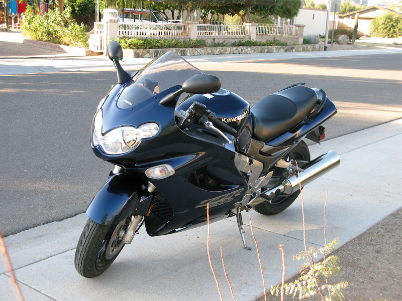
 |
| On the Job at Hilltop |
I am now a veteran of 6.5 hikes (and one helicopter ride) to and from the Havasupai reserve, dating from about 1985 or so. I'm more than willing to answer questions about things I have learned from that experience. If you have stumbled across this essay and have questions about visiting the Havasupai people and their home in the Grand Canyon, you may send me a note at trafficschoolbob43(at)yahoo(dot)com.
There is no other place quite like it in the United States, perhaps not even in the world.