 |
| Helen's Dome overlooks Ft Bowie |
Apache
Pass was a crossroads of human history at a place General George Crook once
described as so barren “a wolf couldn’t make a living on it.” But there is a
perennial spring here. The water just trickles now, but it was once a reliable
enough source that travelers made it a point to stop; good water sources are
few in the southwestern deserts. The spring at Apache Pass was an important
resource and the Army built a post here in the 1860s to protect it – Fort
Bowie.
The location was a place where wildly different cultures came together, sometimes peaceably, sometimes not. The lush desert mountain setting was a favorite camping place for
Apaches and others who were traveling past. Quite possibly, white Americans
first met Cochise here. Teamsters stopped at the spring for water while
freighting from the Rio Grande Valley to Tucson. The Butterfield Overland
Stage, America’s first trans-continental stagecoach company, built a station
there and at first, the locals and the stage crews got along fine. But (soon) the Cochise War began (and ended) at Apache Pass and many years later, the Apache wars
were finally brought to a close altogether at Fort Bowie in 1886. Today it is a peaceful ruin.
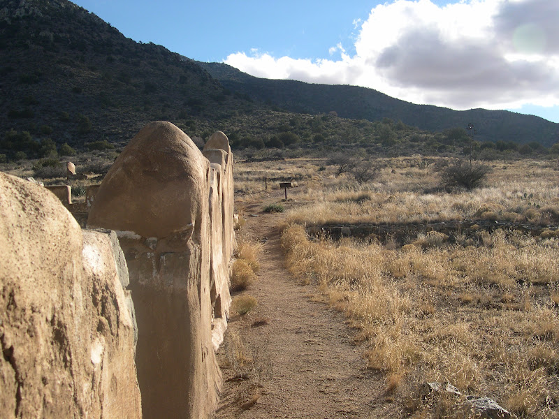
Fort Bowie is south of Interstate 10 in southeastern Arizona. To get there,
Geneviève and I drove from Phoenix to Cochise, AZ, about 220 miles, and then
took Apache Pass Road south about 15 miles to a trailhead. After a picnic lunch,
we donned our hiking boots for the walk to Fort Bowie. The day was a dramatic
one weather-wise, with a sometime-sun creating shadows and contrasts through
broken clouds -- a perfect day for a hike.
 |
| Genevieve at Apache Spring |
 |
| Ruined walls of Ft. Bowie |
What's left of Fort
Bowie has not been “restored.” After closure in the 1890s, local residents came
and stripped it of any useful building materials. Over the years,
rains have washed away most of the remaining adobe walls. As a result of its
ruined condition, there is a mystical or spiritual feel to the place – a feeling I’ve
encountered before at a few places like the Gettysburg battlefield, the Greasy Grass battlefield and
the Alamo in Texas. You can almost sense the history as a tangible thing.
Because Fort Bowie is a ruin, you have only your imagination (and a few old
photographs) to divine what it was like with hundreds of horse-mounted troops
in residence or in review on the parade ground, and how the business of the
Apache Wars kept things bustling. Or I suppose you could just watch one of John
Ford's cavalry pictures...
We spent a few moments looking around in the visitor’s center, talking with the
ranger and walking the perimeter of the ruins. You can see the foundation of
the post commander’s home, and pick out stones still visible today and match
them to the ones plainly visible in frontier-era photos of the house. You can
pick out the exact spot where Geronimo stood for a photo, after his surrender
in 1886. You can see the parade ground, the Stars and Stripes still flying over
it, and imagine a troop of tired cavalry men – perhaps Buffalo Soldiers – as
they awaited the order to “fall out” after a dusty, hot and tedious (and perhaps dangerous) patrol
through the deserts of southern Arizona or northern Mexico.
After our visit, we trekked over the hill that stands over the fort to its
northeast and from the top, looked down on the slopes where the Apaches staged the only
“pitched” battle they ever fought against American troops (one reason the fort
was later constructed here). The Apaches led by Mangas Coloradas, from their positions
in the rocks above, had a commanding view of the soldiers as they approached
the spring and firing down on them, were winning the fight, until the troopers
deployed a couple of small field artillery pieces. Rather than risk heavy
casualties from the bursting shells, the Apaches disengaged and disappeared,
melting into the landscape like rainwater after a desert storm.
 |
| Butterfield Trail route near Apache Pass and Ft. Bowie |
Back in the
truck, Gen and I drove westward over Apache Pass, stopping to look at the old
stage coach road and other sites associated with the Bascom Affair and the
Cochise War, before heading back toward Phoenix.
If you go:
The road over and through Apache Pass is graded dirt, wash-boarded in a few
places but easily passable for passenger vehicles in good weather. From I-10 at
Bowie, AZ, take Business I-10 to the center of town and turn south on Apache
Pass Road. From Bowie, it is about 12 miles to the parking area for the
monument. After your visit at Fort Bowie, you can continue to follow the road
all the way out to SR186, another 9 miles or so. This takes you through the
pass itself and is the same route used by the Butterfield Overland Stage 150
years ago; you will be able to spot the ruts of the old trail still visible in
the area, as it crosses and re-crosses the present road.
Other
attractions in the area include the Chiricahua National Monument, Cochise’s
Stronghold in the Dragoon Mountains, Tombstone, Bisbee and Kartchner Caverns.
The best time to go is in the spring or fall when temperatures are mild, or in
winter when the weather is clear. Lodging can be found easily in Wilcox,
Douglas, Sierra Vista, Benson, or even Tucson.
Rangers
have a permanent presence at the Ft. Bowie site and if you might want to
purchase books at the visitor’s center, carry a small daypack for toting them.
The trailhead area (and parking lot) has shaded picnic tables and a privy for
visitors’ convenience. The ruins of Fort Bowie are reached by means of a
moderately easy 1½ mile hike (one way). Time for a short visit is about 2
hours, but a more thorough look requires 3-4 hours.
 |
| Bob on the trail... |
Wear sturdy
hiking shoes or boots and carry drinking water; watch for snakes and other
critters. They won’t bother you if you don’t bother them, but you need to see
them. Be watchful, conscious of your movements and don't put your hands or feet anywhere you cannot see. The
return hike can be made on the same trail, or on the alternative trail over the
hill (recommended, but much more rigorous). Accommodations can be made for
persons needing assistance under the ADA (contact the rangers). Fort Bowie’s
URL is http://www.nps.gov/fobo/index.htm.
2 comments:
Great Information sharing .. I am very happy to read this article .. thanks for giving us go through info.Fantastic nice. I appreciate this post.
http://clearviewsurfaces.com
Thank you for finally posting the actual distance over the pass..have been looking for this information for days, everyone tells you how far from the parking lot to Bowie, but no one talks about actually going over the pass. Nice article!
Post a Comment